Kovachevsko Kale

Kovachevsko Kale
Kovachevsko Kale is a Late Roman fortress 6 km west of Popovo, near the modern Popovo–Byala road. Discovered and studied by the Czech archaeologist Karel Škorpil, it was initially named Kovachoveshko Kale after the nearby village of Kovachevets. It lies in a flat valley formed where the Kovachevska River flows into its northwestern tributary, the Chepez Dere.
The fortress appears to have been strategically situated, with clear visibility to the east and west, while the north and south are screened by three moderately high plateaux. During the Mesozoic era the area was the bed of a warm tropical sea, as evidenced by finds of belemnite rostra.
Kovachevsko Kale is undergoing archaeological investigation. In September 2010 Popovo Municipality received the fortress grounds for management without payment, with the aim of developing them as a tourist site. Its present-day coordinates are 43°21'33.31"N and 26°8'45.36"E.
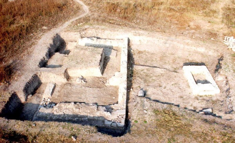
The fortress was declared a cultural monument in 1976 and is a formidable fortification with walls approximately 3.20 m thick. It encloses an extensive area of around 40–45 decares and has seventeen towers projecting from the wall, fourteen of them U-shaped and arranged almost symmetrically. There are four circular towers at the fortress corners, two gates, to the north and west, and a bridge over the Chepez Dere. An underground aqueduct supplied drinking water.
Construction of the fortress is associated with the joint rule of the emperors Licinius I and Constantine I the Great and has been dated to AD 308–324. Excavations have uncovered towers, a sanctuary, various buildings and coins that attest to different periods of its history. The latest layer found above the remains formed in the tenth–eleventh century, underlining this important site's long history.
Targovishte Province, near Popovo, Fourth century
Share: